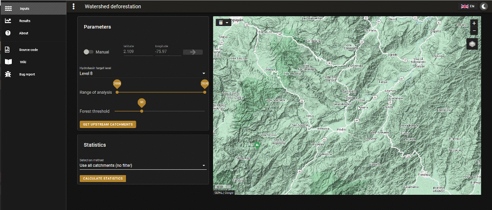
Starting from a point on the map, the module will use the, Global watershed boundaries and sub-basin delineations dataset, derived from HydroSHEDS data at fifteen second resolution, to obtain all the sub-basins that drain towards the selected point at the given detail level.
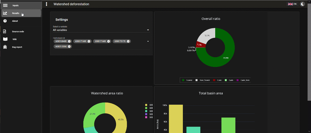
The module will generate a dashboard with zonal statistics using the Global Forest Change dataset v1.8 published by Hansen et al., where we can find zones of change (forests and non-forests) and zones of no change (gain and loss).